These are my favourite overland off-road routes around Mendoza and Argentina. They are easily done with any 4×4 vehicle of any size, big or small. They will take you through some beautiful landscapes with many opportunities to stop for the night, away from civilization. I use the OpenStreetMap-based Mapfactor Navigator on my Android phone to navigate these roads without any difficulty. Google Maps isn’t always reliable in Argentina. Gaia GPS will be fine too. Use the Search box at the bottom of the page to look for posts I might have posted with trip reports to these destinations. Enjoy!
RUTA 13: Just outside Mendoza this provincial road will take you up to over 3000m of altitude with beautiful views over the city of Mendoza, of the “cordillera” and of the snowy Andes. You will certainly encounter guanacos, and most of all peace and solitude during the week. A few 4x4s and dirt bikes use this road on weekends. Check the weather forecast before you go, because rain can make some parts difficult to go through for smaller trucks. The road can be driven either direction. Be sure to stop at the unusual rock formation at Cerro De Los Siete Colores, better if you can be there early morning or late afternoon.
Route on Google Maps Entry point outside Mendoza, GPS: -32.833534 ; -68.872899 Exit point town of Uspallata, GPS: -32.594943 ; -69.335902
RUTA 52: More to the north and more or less parallel to ruta 13 the 52 also end in the small town of Uspallata, but it can be a little more traveled because it has more tourist sites along the way, so you might encounter more traffic. Starting from Mendoza it will take you to Villavicencio where they bottle that brand of drinking water sold in Argentina. Also higher up is a plaque commemorating the passage of Charles Darwin, and the ruins of Spanish mines. Overall the views, landscapes, and wildlife are very similar to ruta 13. You can make a loop of these two roads, and if you start early and don’t mind coming back late, it is quite possible to drive the complete circuit in one day.
Route on Google Maps Entry point Mendoza GPS: -32.810890 ; -68,832208 Exit point Uspallata GPS: -32.567452 ; -69.335200
RUTA 89 Potrerillos to Tupungato: This road as well can be driven either direction. If you start from Potrerillos you will have the option of going to Valle De Uco after. That is where all the major (and many smaller) wineries are located. The municipal campground in Tupungato is large and treed, so that can be an option to overnight. There are some spots to wild camp. They are on iOverlander, and you can probably come up with your own as well. The views are different from ruta 13 or 52, parallel to the mountains this time with more farms and a few more houses. But along this route you might see condors, about a third of the way from Potrerillos.
Route on Google Maps Entry point Potrerillos GPS: -32.960885 ; -69.215815 Exit point Tupungato GPS: -33.301799 ; -69,158199
Vallecito: Also from Potrerillos from ruta 89, you can drive up to the now abandoned ski resort of Vallecito. It is a steep drive up the mountain with a few tight turns but passable for any vehicle. There are a number of hiking trails up there. Check in with the park ranger on the way and ask for ideas.
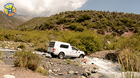
Potrerillos traverse route: Above Potrerillos this is a short narrow 8 km track with a few minor challenges, and some possible overnight camping spots along the way. The thorny bushes on both sides can scratch the paint of vehicles larger than a Jeep. It isn’t recommended for big rigs, though probably doable if you don’t mind driving over the vegetation (Not recommended!). If you start from the south, which I would recommend, then you have to cross a stream after turning off the main road. Depending on the season there can be more or less water. It is usually passable in any 4×4 with reasonable ground clearance. The rest of the trail should be no problem when the weather is dry. I don’t think there is ever any maintenance done on this trail. It looks like a horse trail, so its condition can deteriorate anytime. Let me know how it is if you drive it. Here is a video I did driving it. Have fun! – Entry point Potrerillos GPS: -33.003860 ; -69.282138 – Exit point El Salto GPS: -32.959561 ; -69.282211
More to the south you will find:
LAGUNA DEL DIAMANTE: Accessible only for a short time every year this is the jewel of the Province of Mendoza. If you are here in January or February do not miss it!
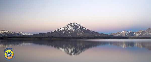
Route on Google Maps Official webpage
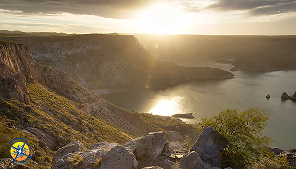
SAN RAFAEL/CAÑON DEL ATUEL: Further south, and south of the city of San Rafael, is this canyon where it is easy to find spots to camp. The views are gorgeous with some interesting rock formations.
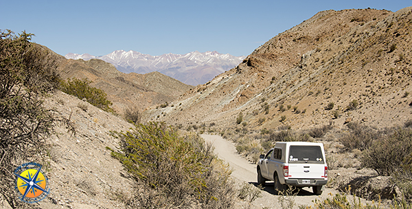
And still further south but still in the province of Mendoza the city of MALARGUE and its many volcanoes have plenty of adventure to be found. Click the link to read my post about it.
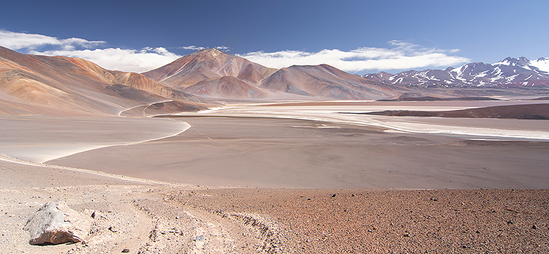
Fiambala, Catamarca province / Atacama desert of Argentina: