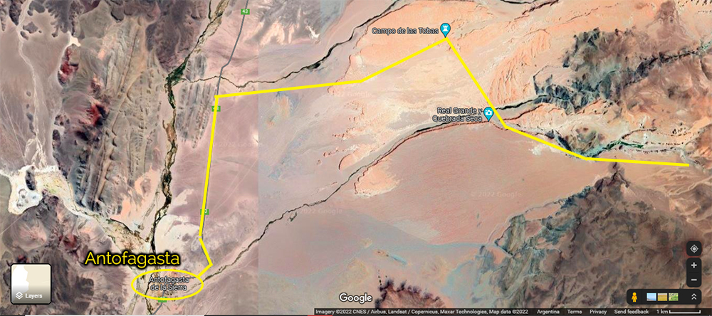
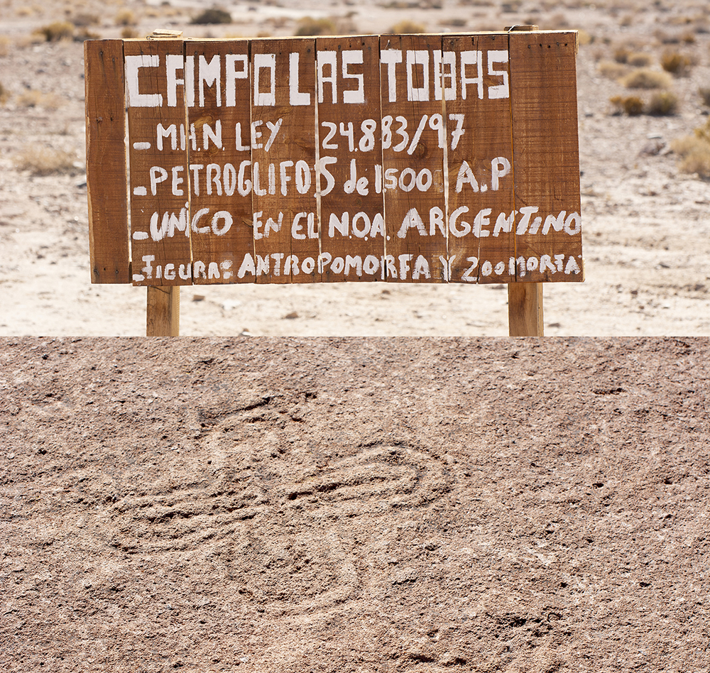
Hello dear readers. In the last article we arrived in the small town of Antofagasta De La Sierra, province of Catamarca. Before we continue on I’d like to mention that the volcano Galán and the laguna Diamante can be reached from a track just north of Antofagasta. Even if you already drove up there from the hamlet of El Peñon as described in the previous post, this track is well worth driving because of the beauty of landscapes along the way, and the views from up there, mostly if you camp along the way. At night you can see the lights of town in the valley below in the distance. That gives you a very powerful perspective of how high you are. Start the road 43 north for a few kilometers then a small track heads east. GaiaGPS map here. The first point of interest is reached shortly after and is signed: Campo De Las Tobas. This is a small but interesting archeological site with pictographs in the rocks in the ground. It is worth taking a few minutes to walk around the site. As always please be respectful and do not step on the pictographs. There are more pictographs in the area but they cannot be found without the help of a local guide. From here already the view to the west, where you came from, is interesting. But we’re just getting started.
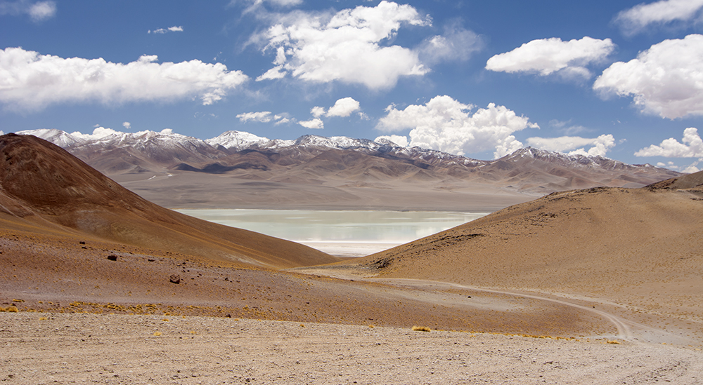
As we push on the track climbs always higher. At about 17 mi. from town and at 14,000 feet you will see a couple of spur tracks to your left. These form a sort of triangle that points to a beautiful area of flat ground large enough for several vehicles, with gorgeous views over a canyon. It is a perfect spot to spend a night in peace and silence, under the stars, with the lights of Antofagasta glittering in the distance below. Be prepared for cold temperature due to the altitude and generally clear sky. The next day you can push on higher to the Vega Real Grande. A vega is a wet flat area, generally with a stream or some kind of running water. The crossing is straightforward but the place is worth a stop, just to stretch the legs, take a photo, and acclimatize to the increasing altitude. Further ahead you will come to a narrow canyon. A mid-size vehicle will fit no problem though with a bit of a challenge since the track has some turns between the rock faces. Larger vehicles will have to do some maneuvering and a spotter will be helpful to keep all the body panels intact. Also remember that you might come back the same way and will have to drive through this canyon a second time. Past this point the only challenge is the increasing altitude, up to 4999 m or 16,400 feet. Once you drive down towards the laguna Diamante you will be rewarded with amazing views of the crater of the volcano Galán. Now, this crater is so big that there isn’t a single spot where you can see it in its entirety. It wasn’t until the first satellite views that scientists realized that this is a crater. You just see an immensity of mountains and a lake. I remind you that altitude sickness is a serious threat. If you feel unwell during the drive do not hesitate to turn around and descend to lower altitude immediately. It will take you a while until you reach an altitude where you feel comfortable again. If you start early enough in the morning, it is quite feasible to drive up to the shore of the laguna Diamante, have a bite to eat, then drive back down to the camp spot mentioned earlier, with ample time to set up camp and watch the sunset. A memorable day indeed. If you intend to connect with the trail from the hamlet of El Peñon you have to head south on a track marked 4×4 only. GaiaGPS shows a track to the north along the lake shore but there isn’t any. I explored on foot looking for it and never found it. In the next post we will leave Antofagasta on a long stretch of remote wilderness: 450 km (about 300 mi.) until the next gas station.