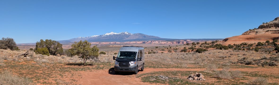
450 kilometers to the next gas station, 3 days in the remote Atacama desert of Argentina without even a hamlet on the way. Dear friends of Sin Rumbo, welcome to today’s article, as we leave the small town of Antofagasta De La Sierra. Before you leave Antofagasta make sure you fuel up your vehicle and buy food and water for the next 4 days. The next town with services is San Antonio De Los Cobres, in the province of Salta. The GaiaGPS route is in 2 parts, Antofagasta to Antofalla, and Antofalla to San Antonio. This last route continues to Cachi, a charming “pueblo” where you’ll find a gas station in case the one in San Antonio is closed when you get there. Remember to carry Argentine pesos because some remote gas stations cannot receive debit and credit cards.
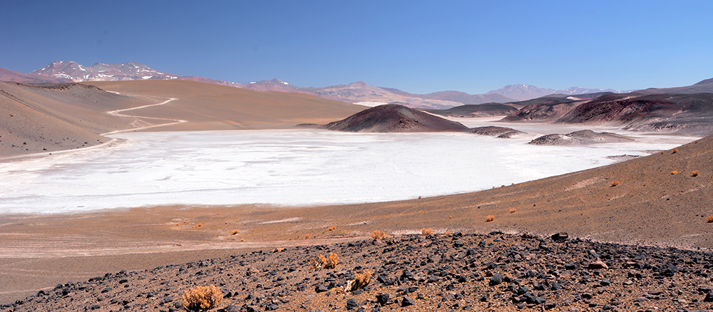
There are no technical difficulties along these routes other than altitude and remoteness. The tracks are punishing though with lots of corrugations. Do not hesitate to lower your tire pressure. The ride will be more comfortable and gentler on your vehicle. I normally run the truck at 36 psi on the highway. I go down to about 28 psi on gravel. Some sections have steep switchbacks at high altitude. Don’t be afraid to use low range 4×4 when necessary. As far as navigation, most of the route should be fairly easy to drive since you will be on provincial roads, but road signs are few and not always placed where most useful. In a few places there are alternate routes for commercial trucks or when the weather makes one road impassable. Do not hesitate to stop and check the GPS before making a choice. It is easy to drive some distance and then have to backtrack. Talking about trucks, when you see a truck approaching move well to the side, stop, and let it pass. It is likely easier for you to maneuver than it is for it. The trucks raise a significant cloud of dirt and dust and driving blind is not worth it, mostly considering that trucks tend to drive in pairs. Since the route traverses remote areas and traffic is very light you can easily find places to stop for a picnic and to overnight. The first stop of interest on our first leg is Ojos Del Campo. There is a sign by the side of the road and plenty of space to park. We made our lunch here. Ojos Del Campo is a group of fresh water ponds in the salt pan. The colours are deep and it is a perfect place for unusual photos. Further ahead is the hamlet of Antofalla. It is worth driving through just to see how far away from civilization some people live. We then push on to Cono De Arita. This is a perfectly triangular hill that seems to have come straight out of the surrouding desert. The most scientific explanation for its formation is that it is a volcanic cone that never erupted.
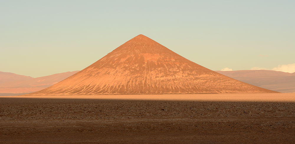
Since coming here was a long drive we camped in the area. If you choose your spot carefully you will get a cool view and photo of the cone at sunset. Sunrise is not as favorable. The next morning we drive to the village of Tolar Grande. This is a mining town with no services. There are hostels though if you need a place to spend a night, and you can probably buy basic groceries. The landscape of the area is absolutely out of this world. Outside Tolar Grande you’ll find another group of fresh water ponds at Ojo De Mar. Those can only be visited before noon. From here it is a very long drive to San Antonio. We arrived on a Sunday afternoon and to our surprise we found the only gas station open. It is cash only though. We then drove on and after a short distance on the pavement we headed south on ruta 40. Just before starting the steep climb to the Abra Del Acay we found a flat spot on the side of the road, good enough for one night. This spot has a fire ring and across the road flows a cute stream. The Abra Del Acay is a pass just shy of 5000 m where you can stop and take photos. The sign is old and the altitude shown is significantly off. From there we descend towards Cachi. The road is in places very narrow with a steep slope on the driver side, and no guard rails. Small and mid-size vehicles will have no problem, but larger vehicles will have to drive carefully and maybe use a spotter for safety. There are also a number of stream crossings. These will not pose a problem in dry conditions but the water level can rise quickly when there are storms in the mountains. The road is well worth driving and not only for the spectacular landscapes on the way down. You are likely to see wildlife: mostly llamas and foxes. South of the hamlet of La Poma you should take a few minutes to walk to the Graneros Inca (Inca graneries). You can drive the sandy track to a parking area where there is space to turn around and leave your vehicle. It is a short walk from there to the site in the rocks. The rest of the drive to Cachi is uneventful but picturesque just the same. After all the time spent in sand dunes and high altitude deserts the sight of green cultivated fields is a pleasant change. Cachi is a very picturesque small town that is well worth a few days. I won’t spoil your own discovery of it. Just know that the municipal campground is one of the best we know in Argentina. It is within walking distance of the main square, shops, cafes and restaurants.

Cachi has capitalized on tourism for years and will deliver a good time. From Cachi many options are available in almost every direction. The city of Salta is not far away and the road is now modern and paved. The park “Los Cardones” is close by if you want to see tall cacti and snowy peaks. There you have it for this section of route. I hope you get to drive it someday and take in for yourself all the views, sites and unique experiences.
